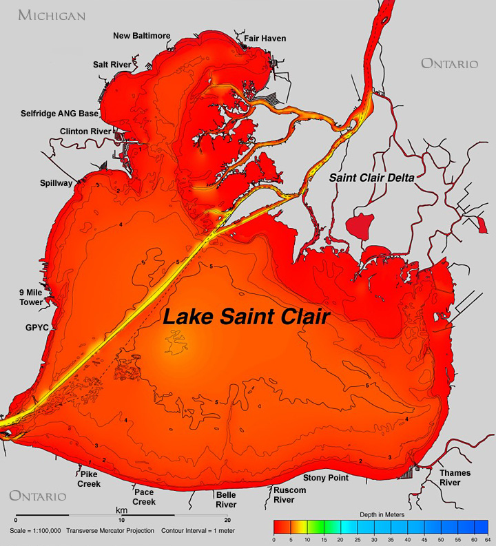
Contour Map of Lake St. Clair:
Length: 26 miles
Width: 24 miles
Average Depth: 10 feet
Max Depth: 21 feet
Surface Area: 430 square miles
Shoreline (counting delta islands): 257 miles
Shoreline (not counting islands): 130 miles
Sea Level: 601.7 feet above sea level
Even though some people do not consider Lake St. Clair part of the Great Lakes, it's still a great lake. It's considered the heart of the Great Lakes because it turns Lake Huron's cold sterile water into warm nutrient water, which feeds millions of fish and is directly responsible for the great fishing in the west-end of Lake Erie. The St. Clair Delta has also produced some of the richest farmland in the world and produces cold crops that cannot grow anywhere else in Ontario. It's the best fishing lake of all the Great Lakes and a major influence on local culture and the local economy. Water-flow through the lake is close to 90,000 gallons per second
The map below is in metres. A metre is basically the same as a yard so just assume 1 metres is 3 feet.